To Devil’s Gorge in Zambia
Eight hours’ off-road driving for a 30-minute site visit
An eight-hour drive through rough terrain for a thirty-minute site visit? It seems excessive, but that is what happened when I was invited by the Zambezi River Authority (ZRA) to visit Devil’s Gorge as part of a proposal preparation. And let me tell you, it was worth it.

Devil’s Gorge is one of Zambia’s hidden gems, tucked away in the rugged wilderness of the country’s southern region. This untouched, raw piece of Earth lies downstream of the Victoria Falls and upstream of the Kariba dam on the Zambezi River. The site was identified in 1972 for the development of a 1240 MW hydropower plant with a 181 m-high dam. In 2016, a preliminary analysis of the Devil’s Gorge project was conducted. The site was accessed from the Zimbabwe side by boat. However, on the Zambia side, the site had not been accessed until recently.
As I set out to this remote location, I am filled with anticipation and excitement. Little do I know that the trip will be an adventure, filled with unexpected challenges and unforgettable experiences.
The client warned us to come prepared. Recommended is not only the use of a 4×4 vehicle but preferably a 4×4 heavy-duty Land Cruiser. This was the first hint of what we were to expect on this journey.
“Having traveled to the meeting point in Choma the day before, I felt well prepared, ready to embark on the adventure to Devil’s Gorge.”
The distance from Choma to Devil’s Gorge is estimated to be 200 km. Punching into Google Maps our destination as Devil’s Gorge, I quickly realized that Google Maps had no clue about the final route to this hidden gem. So we broke down the trip: Choma to Maamba and then onwards to Siamsalama.
")
From Siamsalama about 15 km before our destination, we will have to rely on a track made by the local villagers for us to access the site. This is a further indication that this trip could be unusual, exciting, and adventurous. The client briefed us that he had tried to access the site three weeks prior, but was defeated by the rugged terrain. However, he convinced us, that we would reach our destination this time around, because it had not rained for the past week.
At 6:30 a.m., we set off in eight vehicles from Choma to Maamba, a small mining town 12 km away from Lake Kariba. The first 90 km are on a dust road that tests the suitability of the vehicle we are traveling in. Covering the 90 km in two and a half hours is not bad to start with.
At 9 a.m., we arrive in Maamba and meet at a filling station, the last filling station 110 km away from Devil’s Gorge. We stock up with drinking water and snacks and try to fuel the vehicles. It turns out that this filling station has run out of diesel fuel and the next filling station that might have diesel is one hour’s drive away in the opposite direction to where we are going. As we cannot afford such a detour, we leave the cars without enough fuel and the cars deemed unfit for the rest of the journey in Maamba. We continue with four of our eight vehicles towards Siamsalama.


Passing through small villages and lush green landscapes dotted with trees and bushes, we cross valleys and small rivers and climb hills. We are treated to an amazing view of the Zambezi escarpment and a feeling of driving through landscape described in history books on the exploration of Southern Africa – scenes and landscapes befitting any safari Hollywood movie. We are greeted by waving children and curious onlookers. In over 100 km, we only meet five other cars traveling our way.
Still enjoying the drive, we listen to the radio playing the AC/DC song “Highway to Hell”. Is this coincidence or is a higher power wanting to tell us something?
At 12:30 p.m., we reached Siamsalama, the last village known to Google Maps, about 15 km from Devil’s Gorge. So far, it has taken us six hours for 185 km. The last 15 km are covered at walking speed.
Driving through this amazing landscape is a thrilling experience. The variety of vegetation all within the space of a few kilometers is nothing less than marvelous. We pass forest-like areas, only for these areas to open up to savanna-like plains with grassland and sandy soils, leading us on to swampy and muddy areas that are displaced by rocky patches through riverbeds and valleys.
It isn`t long before we encounter our next challenge.
The radio starts giving up on us. The poor radio signal finally forces us to switch it off, as we cannot even recognize the song being played. The last song I imagine to hear is Celine Dion’s “I’m Your Angel” with the line: “No mountain’s too high for you to climb …. “. Another hint by the almighty?
At 2:30 p.m., we finally arrive at the edge of the gorge.
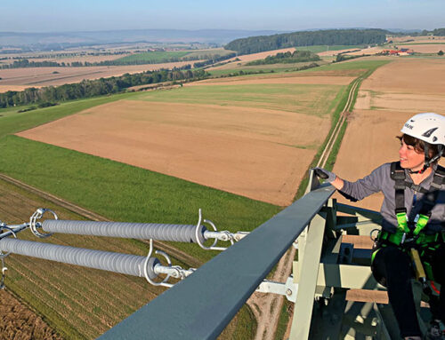
100 meters above the mighty Zambezi River, we are treated to a breathtaking view. The sight of the gorge and the natural beauty that surrounds it is awe-inspiring.
I feel privileged to be able to experience such a beautiful and untouched part of Earth.
We have reached Devil’s Gorge. We forget, at least for a moment, the eight-hour drive we have endured to get here and the drive back we have in front of us.
The local people call this stretch of the Zambezi River “LesaSambe”, which translates to “God’s Bath”. This is a far more befitting name for such a pristine and untouched piece of nature. I make a mental note to try to find out why God’s Bath was translated to Devil’s Gorge.


As we marvel at the view, the client calls us back to reality. We have to leave in 30 minutes because it gets dark at 6:30 p.m., and we don’t want to be stuck in the dark.
After a brief from the client explaining his ideas and his request to identify the most suitable dam site within this gorge, we get back into the cars and make our way towards Lusaka.
Experienced as we are now and knowing the challenging road sections, we cover the first 15 km in a record time of one hour.
Back within radio coverage and in Google Maps territory, we check the distance to Lusaka: 430 km – eight hours to go. We decide to look for accommodation in Maamba. Sadly, the lodges in Maamba are fully booked. We are left with no choice but to continue towards Lusaka with the aim of reaching Monze, the next bigger town, to find accommodation for the night. Despite being a main road, the road towards Monze is in very poor condition, and only 4×4 vehicles can drive on it.
The night is pitch-black, and the little light the moon gives us makes the drive mysterious. We have to stay concentrated as we pass ox-pulled scotch carts, a popular means of transport in this part of Zambia.
At 11 p.m., we finally arrive in Monze and stop at the first lodge we can find. To our disappointment, the guard tells us that the receptionist left at 10 p.m., and no guests are admitted once she leaves. Tired and exhausted, we decide to look no further and manage to convince the guard to let us stay in the lodge car park and sleep in the car.
As we settle in for the night, the radio plays “Heaven for Everyone” by Queen.
I smile to myself. Today, I have been on the highway to hell, climbed no mountain too high, seen paradise, and now I am being told this could be heaven for everyone. Before I know it, I fall asleep.
This 30-minute site visit is an adventure I will not forget easily. Tomorrow we shall reach Lusaka.
March 2023

Kabengele Heribert Bredt
Head of the Fichtner Office Nairobi